 | 119.3 km (74.13 mi). Tokyo Bay Aqua-Line—part of Japan National Route 409 "一般国道の路線別、都道府県別道路現況" [Road statistics by General National Highway route and... 2 KB (83 words) - 03:01, 21 March 2024 |
 | National Route 15 (国道15号, Kokudō Jūgo-gō) is a national highway connecting Tokyo and Yokohama in Japan. It is commonly referred to as Dai-Ichi Keihin... 4 KB (223 words) - 04:33, 20 April 2024 |
National Route 1 (国道1号, Kokudō Ichi-gō) is a major highway on the island of Honshū in Japan. It connects Chūō, Tokyo in the Kantō region with the city... 66 KB (842 words) - 08:45, 8 May 2024 |
 | National Route 7 (国道7号, Kokudō Nanagō) is a major north-south national highway on the Sea of Japan side of the island of Honshū, Japan. It traverses four... 35 KB (473 words) - 01:55, 18 March 2024 |
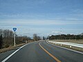
National Route 465 (国道465号, Kokudō Yonhyaku roku-jūgogō) is a national highway located entirely within Chiba Prefecture, Japan. It connects the cities... 16 KB (841 words) - 17:44, 6 August 2023 |
 | National Route 238 (国道238号, Kokudō Nihyaku sanjūhachi-gō) is the northernmost of the national highways of Japan. It connects the cities of Abashiri and... 9 KB (207 words) - 22:57, 25 June 2023 |
"新突破!城开高速控制性工程吴家梁隧道掘进4000米大关_高速公路". www.sohu.com. Retrieved 2020-10-11. "国道109新线饮马鞍隧道开挖进尺突破4000米!". j.021east.com. Retrieved 2022-05-22. 网易 (2021-09-11)... 122 KB (3,503 words) - 12:51, 19 April 2024 |
National Route 410 (国道410号, Kokudō Yonhyakujūgō) is a national highway located entirely within Chiba Prefecture, Japan. It connects the cities of Tateyama... 15 KB (516 words) - 17:43, 6 August 2023 |
 | Chiba and Takanezawa, Tochigi, with a total length of 116.9 km (72.64 mi). "一般国道の路線別、都道府県別道路現況" [Road statistics by General National Highway route and prefecture]... 1 KB (73 words) - 03:00, 21 March 2024 |
 | (36.66 mi). National Route 296 was first constructed on April 1, 1970 "一般国道の路線別、都道府県別道路現況" [Road statistics by General National Highway route and prefecture]... 2 KB (81 words) - 01:42, 18 March 2024 |