
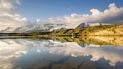
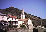
La Chapelle-en-Valgaudémar is a commune in the Hautes-Alpes department in southeastern France. La Chapelle-en-Valgaudémar has a humid continental climate...
5 KB (192 words) - 14:06, 20 September 2023
Embrun, Entraigues, Freissinières, L'Argentière-la-Bessée, La Chapelle-en-Valgaudémar, La Grave, La Motte-en-Champsaur, Lavaldens, Le Bourg-d'Oisans, Le Monêtier-les-Bains...
4 KB (327 words) - 11:45, 14 November 2023
Jerusalem Itinerary, which makes the Alpes Cottiae commence at Rama (near modern La Roche-de-Rame) between Embrun and Briançon. In the 1040s it came into the...
15 KB (1,442 words) - 09:49, 30 April 2024
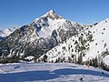
lifts and 94 slopes including 9 green, 25 blue, 45 red and 15 black runs. Chapelle Saint-Roch in March 2008 Montgenèvre in February 2014 Montgenèvre from...
13 KB (1,476 words) - 19:02, 9 January 2024
Aspres-lès-Corps Chauffayer Le Glaizil La Chapelle-en-Valgaudémar Saint-Firmin Saint-Jacques-en-Valgodemard Saint-Maurice-en-Valgodemard Villar-Loubière Cantons...
2 KB (129 words) - 15:00, 29 March 2022

La Chapelle-en-Valgaudémar La Fare-en-Champsaur Forest-Saint-Julien Le Glaizil Laye La Motte-en-Champsaur Le Noyer Orcières Poligny Saint-Bonnet-en-Champsaur...
3 KB (196 words) - 10:18, 17 March 2021

distant. 15 km (9 mi) separates Gap from La Saulce on the A51 motorway. This highway provides fast travel to Aix-en-Provence and Marseille 170 kilometres...
85 KB (8,620 words) - 10:20, 25 May 2024
Studies. 28 December 2023. Population en historique depuis 1968, INSEE Official Web site (in French) L'Argentiere-la-Bessee - Description in French and pictures...
3 KB (181 words) - 03:22, 1 August 2023
Statistics and Economic Studies. 28 December 2023. Population en historique depuis 1968, INSEE Wikimedia Commons has media related to La Saulce. v t e...
2 KB (77 words) - 03:26, 1 August 2023

to the village of St Christophe en Oisans from which alternative transport must be arranged in order to return to La Grave or to join the Deux Alpes lift...
6 KB (723 words) - 03:23, 1 August 2023