
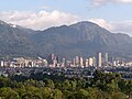
Cerro Pan de Azúcar (Sugar Loaf Hill) is among the top 10 highest points of Uruguay, with an altitude of 423 metres (1,387.8 ft). It is located southwest...
3 KB (284 words) - 00:20, 7 December 2023

Cuchilla Santa Teresa (2,200 mamsl), the hill of Los Gallinazos in Pan de Azúcar (1,800 mamsl), the hill Morrón, La Siberia and the Ancón. The main stream...
5 KB (369 words) - 07:00, 30 March 2024
Pampa del Tamarugal Aquifer Pica Aquifer Purapurani Aquifer Valle de Pan de Azúcar Aquifer San Diego County Water Authority - Water Management - Local...
4 KB (361 words) - 19:01, 13 May 2024

Ábrego (category Municipalities of the Norte de Santander Department)
the Juridiscciones Moor has about 2800 hectares, specifically in the Pan de Azúcar Lagoon, where the Oroque and Frío rivers are born, which form the Algodonal...
17 KB (1,129 words) - 17:45, 17 June 2024

groups own 75% of the land: the State Sugar Council (Consejo Estatal del Azúcar, CEA), Grupo Vicini, and Central Romana Corporation. According to the 2016...
270 KB (24,599 words) - 02:26, 13 June 2024

Blessed Jacinto Vera Durán (Atlantic Ocean, 3 July 1813 – Pan de Azúcar, Uruguay, 6 May 1881) was a Uruguayan Roman Catholic prelate who served as the...
13 KB (1,342 words) - 00:34, 27 May 2024

gaita (pequeña flauta de sonidos muy agudos y con solo siete agujeros) y del tamboril, instrumento cónico, semejante á un pan de azúcar, muy estrecho, que...
71 KB (8,675 words) - 04:23, 6 June 2024
Eastern Hills (Bogotá) (redirect from Cerros orientales de Bogotá)
Aguanoso, Pico del Águila, El Cable, El Chicó, El Chiscal, La Laguna, Pan de Azúcar and La Teta. From north to south, the rural areas of the localities...
100 KB (9,719 words) - 11:23, 20 March 2024

Central; its highest peaks are Paramo de las Hermosas (3,500 meters high), the Cerro Pan de Azúcar and El Alto de la Cruz. The second area is flat or slightly...
18 KB (1,883 words) - 19:12, 17 June 2024

Nº 18.644 del 12 de febrero de 2010 Ley Nº 18.653 del 15 de marzo de 2010 Listado y ubicación de los Municipios en Uruguay - Oficina de Planeamiento y Presupuesto...
36 KB (480 words) - 21:02, 26 May 2024