
Scraptoft is a village in Leicestershire, England. It has a population of about 1,500, measured at the 2011 census as 1,804. It lies north of the A47...
9 KB (1,180 words) - 10:49, 25 April 2023

Scraptoft Hall is a former Georgian country house in the village of Scraptoft, Leicestershire, England. A Grade II* listed building, it has since been...
7 KB (890 words) - 03:20, 27 March 2024

Scraptoft Nature Reserve is a 14.3 hectares (35 acres) Local Nature Reserve in Scraptoft, on the eastern outskirts of Leicester. It is owned and managed...
2 KB (119 words) - 16:37, 31 March 2023
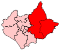
Harborough district up to the boundary of the city of Leicester (for example Scraptoft). The constituency was considered a safe Conservative seat throughout...
25 KB (768 words) - 14:36, 27 May 2024

includes parts of the Leicester Urban Area, notably at Thurnby, Bushby and Scraptoft. Covering 230 square miles (600 km2), the district is the largest by area...
26 KB (1,873 words) - 11:14, 6 March 2024
Town 16,850 Thurmaston 9,668 Glenfield 9,109 Leicester Forest East 6,719 Glen Parva 6,189 Kirby Muxloe 4,667 Thurnby and Bushby 3,301 Scraptoft 1,804...
16 KB (606 words) - 10:56, 29 October 2023
and Scraptoft railway station was a railway station in Thurnby, Leicestershire on the Great Northern Railway Leicester branch. Thurnby & Scraptoft railway...
3 KB (349 words) - 21:52, 6 July 2023

Calling at Arrival Operator 07.00 Peterborough North Humberstone, Thurnby & Scraptoft, Ingersby, Loseby, Tilton, East Norton, Hallaton, Medbourne, Rockingham...
7 KB (292 words) - 12:57, 8 December 2020

Market Harborough North, Market Harborough South, Market Harborough West, Scraptoft, Thurnby, and Tilton, and the Borough of Oadby and Wigston. 1997–2010:...
57 KB (1,245 words) - 18:24, 28 May 2024
the Uppingham Road, east of the A563 outer ringroad, and south of the Scraptoft Lane. Since the core area around Thurncourt Road is a council estate many...
3 KB (424 words) - 11:49, 17 April 2024