destroyed, or swept away by the 2011 Tōhoku earthquake and tsunami event. "一般国道の路線別、都道府県別道路現況" [Road statistics by General National Highway route and prefecture]...
2 KB (116 words) - 21:44, 20 March 2024
National Route 13 (国道13号, Kokudō Jūsan-gō) is a highway in Japan on the island of Honshū which runs from Fukushima in Fukushima Prefecture to Akita in...
4 KB (217 words) - 02:02, 18 March 2024
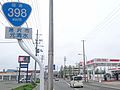
National Route 4 (国道4号, Kokudō Yongō) is a major national highway in eastern Honshū, Japan. Measuring 738.5 kilometers long (458.9 mi), it is the longest...
70 KB (1,026 words) - 08:40, 8 May 2024

National Route 7 (国道7号, Kokudō Nanagō) is a major north-south national highway on the Sea of Japan side of the island of Honshū, Japan. It traverses four...
35 KB (473 words) - 01:55, 18 March 2024
National Route 45 (国道45号, Kokudō Shijūgogō) is a national highway of Japan connecting Aoba-ku, Sendai and Aomori, Aomori. Alongside Japan National Route...
12 KB (889 words) - 10:47, 7 August 2023
National Route 105 (国道105号, Kokudō Hyaku gogō) is a national highway of Japan that traverses the prefecture of Akita in a southwest–northeast routing....
14 KB (746 words) - 18:56, 11 March 2024
"新突破!城开高速控制性工程吴家梁隧道掘进4000米大关_高速公路". www.sohu.com. Retrieved 2020-10-11. "国道109新线饮马鞍隧道开挖进尺突破4000米!". j.021east.com. Retrieved 2022-05-22. 网易 (2021-09-11)...
122 KB (3,503 words) - 12:51, 19 April 2024

Miyagi-Kenpoku Road 国道%route%号 みやぎ県北高速幹線道路 (Miyagi-Kenpoku Kōsokukansenōro) Route information Maintained by Miyagi Prefecture Length 24 km (15 mi) Existed...
4 KB (243 words) - 14:13, 4 May 2024
"新突破!城开高速控制性工程吴家梁隧道掘进4000米大关_高速公路". www.sohu.com. Retrieved 2020-10-11. "国道109新线饮马鞍隧道开挖进尺突破4000米!". j.021east.com. Retrieved 2022-05-22. "景文3标项目叶麻尖1#隧道顺利进洞施工"...
104 KB (2,809 words) - 20:26, 31 December 2023

Yuzawa-Yokote Road 国道%route%号 湯沢横手道路 (Yuzawa-Yokote Dōro) Route information Maintained by East Nippon Expressway Company and Ministry of Land, Infrastructure...
4 KB (232 words) - 17:02, 6 January 2024