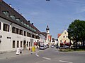
Grafing (redirect from Grafing bei München)
town has the following traditional rural land units (Gemarkungen in German): Elkofen, Grafing b.München, Nettelkofen, Oexing and Straußdorf. Grafing station...
8 KB (877 words) - 08:51, 1 April 2023

Sendelbach [de], Steinbach [de] and Wombach [de]. The town has the following Gemarkungen (traditional rural cadastral areas): Halsbach, Lohr a. Main, Pflochsbach...
26 KB (2,830 words) - 02:16, 27 May 2023

main highway in the Aßling area. Aßling also holds two rural areas (Gemarkungen), Aßling and Loitersdorf. Aßling had its first documentary mention, as...
5 KB (538 words) - 11:55, 3 June 2023
Walchsing Weidfeld Weng Wetzstein Wifling These are assigned to the Gemarkungen (sub-districts) of Pörndorf, Walchsing, Aldersbach and Haidenburg. Johanniskirchen...
10 KB (988 words) - 15:00, 9 May 2023

Wiebelbach, 1972, 201 Röttbach, 1978, 569 The municipality has the following Gemarkungen (traditional rural cadastral areas): Kreuzwertheim, Röttbach, Unterwittbach...
9 KB (1,139 words) - 14:21, 13 April 2023

forest accounts for almost 1,600 ha. The community has the following Gemarkungen (traditional rural cadastral areas): Erlach am Main [de] (on the left...
16 KB (1,566 words) - 08:03, 1 January 2023

Kleinkahl and Kleinlaudenbach. The community has the following five Gemarkungen (traditional rural cadastral areas): Edelbach, Großkahl, Großlaudenbach...
6 KB (697 words) - 14:01, 24 September 2022

south it borders on Baden-Württemberg. The community has the following Gemarkungen (traditional rural cadastral areas): Homburg am Main, Lengfurt, Rettersheim...
26 KB (2,708 words) - 06:43, 6 January 2023